

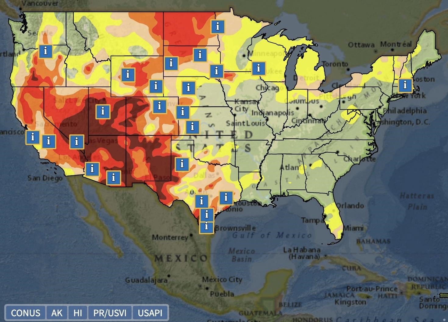
On April 14, the National Integrated Drought Information System (NIDIS) and National Weather Service (NWS) launched a new interactive map on Drought.gov that provides drought information statements from NWS Weather Forecast Offices (WFOs). Drought information statements provide up-to-date reports on the current drought situation for a WFO’s county warning and forecast area. These statements summarize recent weather and hydrologic conditions, discuss local drought impacts, and provide a local drought outlook.
This new interactive map on Drought.gov allows users to explore all active drought information statements published within the last 35 days, overlaid on the U.S. Drought Monitor. In addition to the link below, the new map can be found on the Data and Maps/Drought Impacts page on Drought.gov.


")